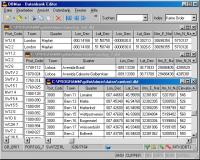
Geodata International - World-wide database of countries with georeferenced towns, municipalities, postal codes and administrative units with WGS84 and UTM coordinates and elevations for geocoding, proximity search, navigation, distance calculation.
Geodata International - World-wide database of countries with georeferenced towns, municipalities, postal codes and administrative units with WGS84 and UTM coordinates and elevations for geocoding, proximity search, navigation, distance calculation. Often is it necessarily, for an address characteristic, e.g. the place name or the postal code, to establish a local relationship - a georeference. The georeference can be used e.g. to show a customer the nearest chain store by doing a proximity search. On the basis of the georeferences business zones, statistics or general maps can be made. Towns, municipalities and postal codes can be assigned to the superordinated administrative units. Distances between places or postal areas can be determined with the coordinates contained in the database tables. For that the georeferences are available in all country database tables as UTM coordinates on the natural and an uniformly meridian strip and as geographical coordinates in degree and deg/min/sec notation. With the elevation data from a Digital Elevation Model the ground level height of each place can be determined. The database tables are present in the file format CSV (Comma Separated Values). The character set used is UTF8. This format is used often and in most cases you can import data directly into your own data system. The freeware program CONVERT, downloadable from the KilletSoft site, converts the available database tables to other data formats and character sets with the necessary sortings and selections. With the program, for example, CSV data can be converted to the SDF format (Simple Document Format) or to the dBase format. For the use of the data on different platforms it is possible to select between the character sets ASCII, ANSI, UTF8 and UniCode. Thus the import of the data in any database management system or file system will be possible.
Whats new in version 4.10:
Datenbanken nach landesspezifischen Zeichens�tzen sortiert. Datenbanken Belarus und Luxemburg erneuert. Datenbank Germany wegen Kreis-Gebietsreform in Mecklenburg-Vorpommern aktualisiert. Datenbanken �sterreich und Malaysia erneuert. Datenbestand um 97 L�nder erweitert.
Requirements:
All systems
Operating system:
Linux,Mac OS X,Pocket PC,Unix,Win2000,Win7 x32,Win7 x64,Win98,WinMobile,WinOther,WinServer,WinVista,WinVista x64,WinXP,Other
Release notes:
Major Update

MSSQL to MySQL database converter software converts MSSQL database, even tables are stored at new location or overwrite the existing MySQL database. MSSQL to MySQL table migration utility converts table and stores that database at specified location.
Price: $45, Rating: 8.33, Downloads: 195
Download

Do you have such kind experience that you can not view the complete SQL Script because of the reason with "WITH ENCRYPTION" when you view the Stored Procedure, View, Trigger and Function of MS SQL SERVER? If yes, the DecrypSQL can help you.
Price: $79.95, Rating: 9, Downloads: 148
Download
SQL SP Generator is aSQL Stored Procedure Generator add-in for SQL Server Management Studio.
Price: $ 19.95, Rating: 10, Downloads: 136
Download